News
How OBIS Data and Model-Based Tools Can Support Marine Protected Areas
1 August 2025
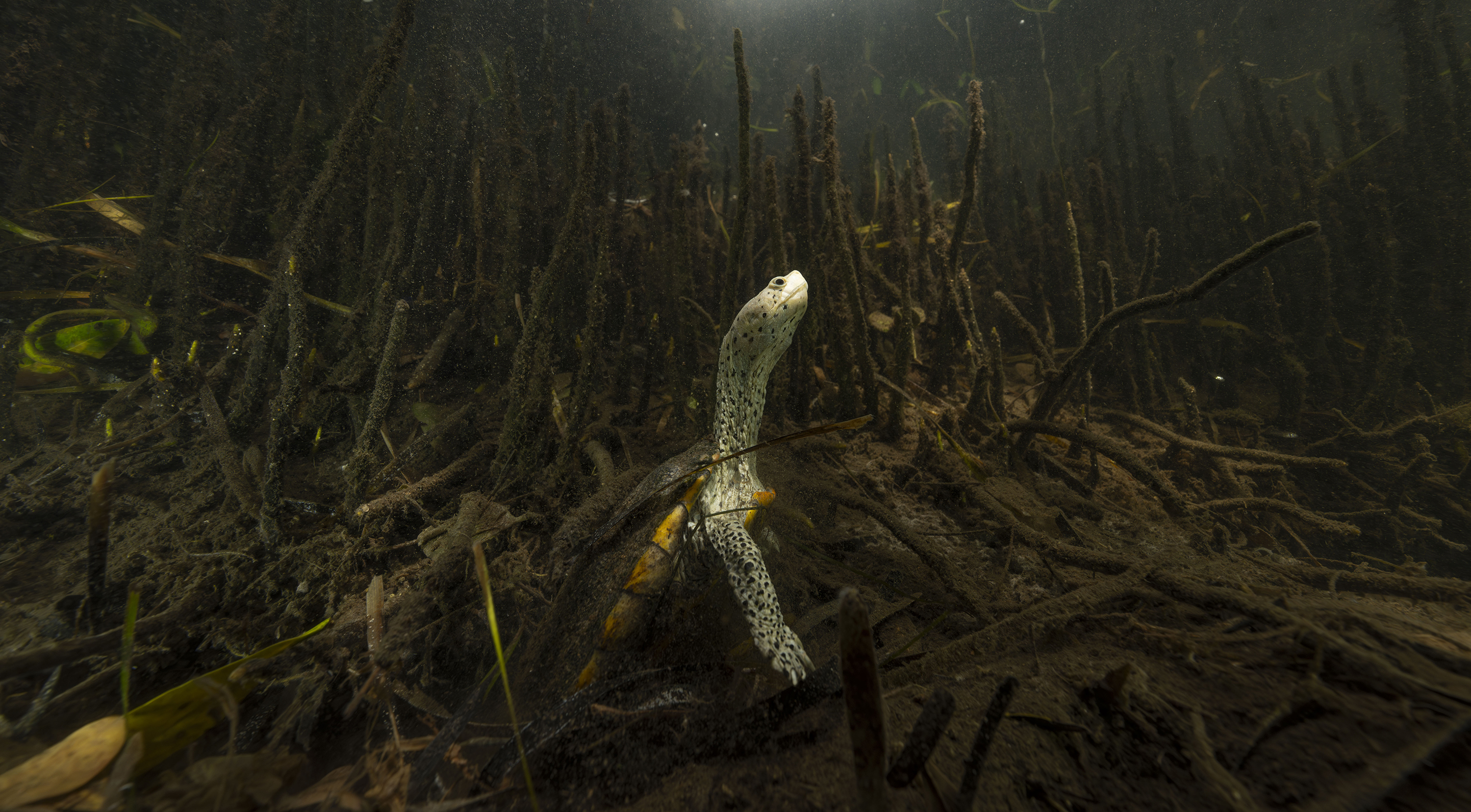 Guardians of the Gulf Coast Mangroves: A diamondback terrapin turtle in the brakish waters of a coastal mangrove. Photo: Nick Conzone / Ocean Image Bank
Marine Protected Areas (MPAs) have proven highly effective in conserving, and in some cases restoring, marine biodiversity. The State of the Ocean Report 2024, using OBIS data, highlighted that over half of all marine species, and 72% of threatened species, have been reported in Marine Protected Areas. With just over 18,000 MPAs worldwide, and most protection concentrated in the 100 largest sites, vast swaths of the Ocean remain unprotected and vulnerable. From a scientific point of view, supporting the implementation of future MPAs is a complex challenge. It involves mobilizing comprehensive data and analysis to produce actionable, reliable foresight so decision-makers can plan effectively for the future of Ocean health.
During the MPA Europe project, the OBIS team has successfully developed an innovative, scalable, data-driven modeling approach to support the planning of future Marine Protected Areas. At its core are the Species Distribution Maps, which shows the potential range of species by combining data about the species, with environmental information such as currents, salinity, and temperature. The model also incorporates projections from five IPCC climate scenarios to produce high-resolution predictions of potential range shifts for more than 12,000 European marine species at a scale of five square kilometres. The Species Distribution Maps help identify ecologically significant areas, assess climate resilience, and guide protection efforts even where observational data are sparse. They contribute to making marine planning more reliable and cost-effective, including in remote or undersurveyed regions. Building on this approach, the OBIS team is also developing the Species Grid. This global framework aggregates data from OBIS and the Global Biodiversity Information Facility into a high-resolution, gridded dataset supporting marine spatial planning far beyond Europe.
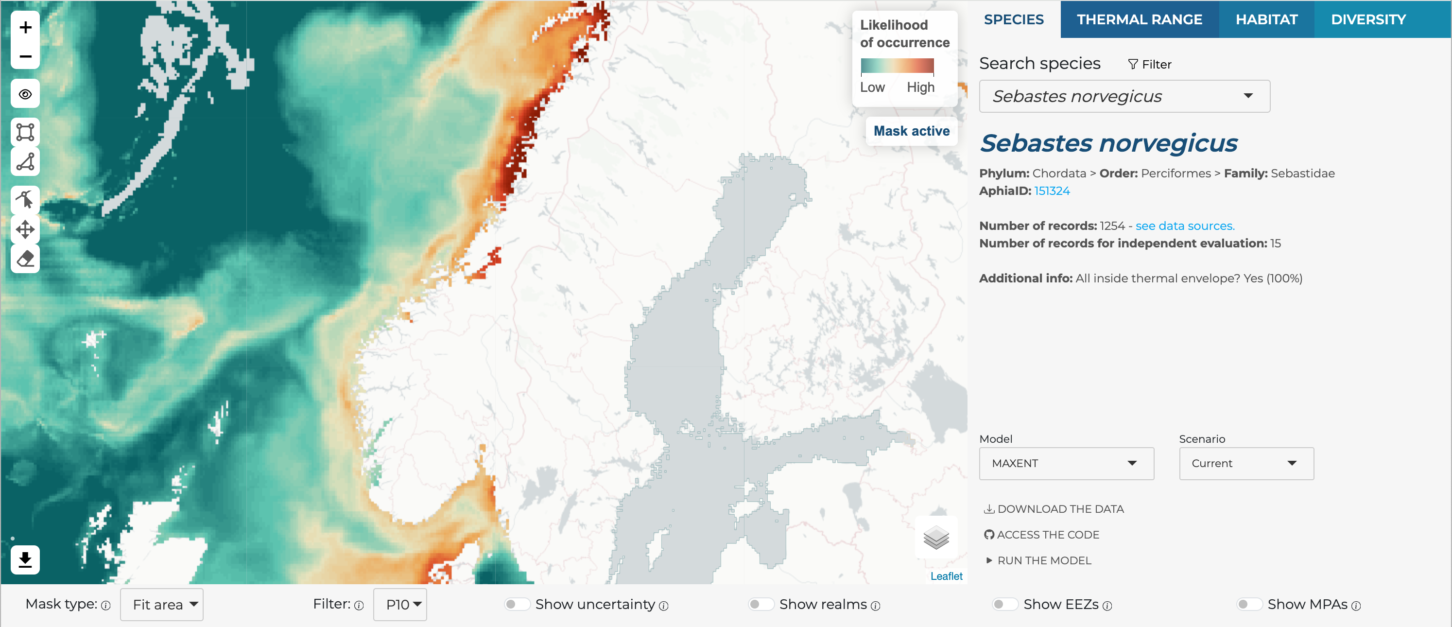 A screenshot of the Species Distribution Maps. This application developed by OBIS enable the user to explore the maps with the potential range of over 12,000 marine species occurring in European waters. Users can compare different algorithms, check model details and performance metrics, and explore different climate scenarios. All maps include an uncertainty layer, helping users to critically use the results in any assessment. All data and associated code is totally open access, and can be adapted and extended to other use cases. A new, improved, version of the models will be launched by the end of August 2025.Credit: OBIS
Because these tools are open and reproducible, researchers, governments, and conservation organizations worldwide can adapt them to regional needs, helping advance global biodiversity goals, such as the 30x30 Target (Target 3 of the Kunming-Montreal Global Biodiversity Framework: Effectively conserving 30% of land, inland waters, and ocean through well-connected, equitably governed protected areas and Other Effective area-based Conservation Measures by 2030). The Species Distribution Maps and the Species Grid are flexible and can be combined with additional tools to better match the user’s needs. Within the MPA Europe project, for example, the Species Distribution Maps have been combined with blue carbon habitat predictions into a tool producing a prioritized list of potential MPA sites. Finally, designed for scalability, these solutions could also support implementation of the Biodiversity Beyond National Jurisdiction Agreement (BBNJ), particularly its “Area-Based Management Tool” pillar, by providing authorities with robust, science-based conservation planning capabilities.
Beyond planning new MPAs, OBIS data also play a critical role in monitoring and improving existing protected areas. Marine managers and decision-makers can use the 161 million biodiversity records and nearly 27 million DNA sequences available on obis.org to assess the efficiency of their conservation actions. OBIS data support adaptive management, helping authorities detect biodiversity shifts, assess connectivity between protected zones, and adjust conservation strategies to ensure efficient Ocean protection in the face of rapid environmental change.
You can read more on the Species Distribution Maps in our dedicated article here.